In the interest of full disclosure, I guess I should get this out of the way: I cheated a little on this segment. I took a route away from the road from the beginning of the hike at the visitor center to park headquarters around mile 3. Instead of following the road, I took a longer route along a low ridge, the Rock Creek trail. It added a mile or so to my total distance, but the views I got as a result of climbing some 400 feet up were worth it.
 |
| To the south |
 |
| And to the north |
The actual creek is well below the trail in a small canyon. The ridge that the path follows is the division between the Rock Creek drainage and the wide valley in which the Park Road is located, and it's high enough that you can't see the stream except in a few spots.
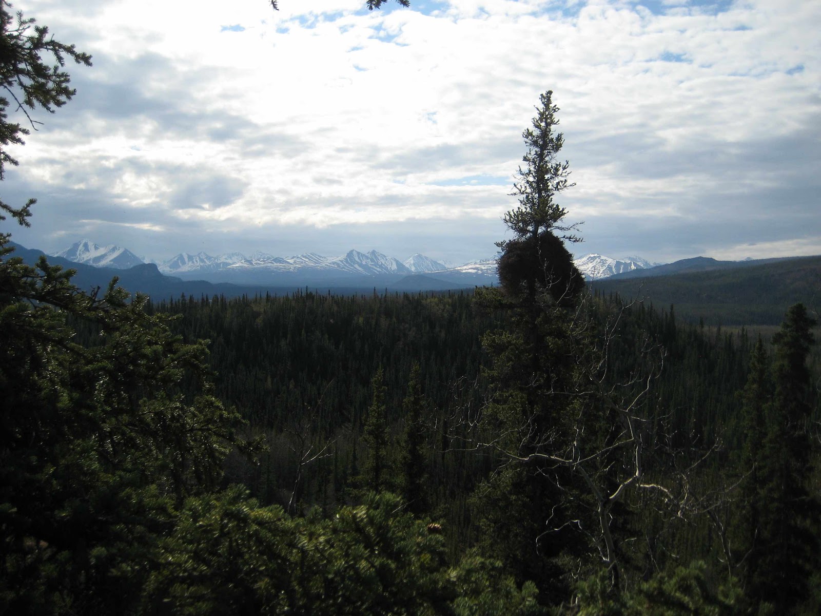
Once the trail dropped from the ridge back toward the road, I continued west. It was about 11:00 AM at that point, and I had 12 miles of walking in front of me to reach the Savage River bridge. I figured I would be able to make it by 3:00 and catch the 3:30 shuttle back to the visitor center. I knew that I would be ascending for about the first half of the walk, then descending for the latter half, as I crossed from the basin of the Nenana River (the eastern boundary of the park) to the Savage River. Views like this looking back toward the east (that is, behind me) were pretty common. It may not look steep, but after two hours of this, you hope for a flat stretch around every bend.
 |
| Mile 6 (+/- 1) |

As I got closer to the crest of the road at around 3000 feet above sea level (over 1500 feet above my start point), the density of trees got lower and lower. In the taiga at lower elevations, the forest is dominated by black spruce, with a lot of birch and alder mixed in. The birch and alder disappeared pretty early on, probably at around 2200 feet, and above 2500 feet, the spruces started to thin out. 3000 feet isn't far below the tree line at this latitude, so ultimately what had once been thick woods ended up as this.

 |
| Mile 9 |
 |
| Mile 11; Denali is about 75 miles away |
The last 5 or 6 miles were mostly downhill, since Savage River meets the Park Road at about 2500 feet above sea level. As a result, I got good views down into the river valley in the last couple of miles, as well as a view of the road climbing again as it passes south of Primrose Ridge.
 |
| Mile 14: The Upper Savage River |
 |
| And the road beyond. |
I reached the Savage River bridge earlier than I expected, at about 2:40 in the afternoon. In the previous five hours, I had walked about 14 miles, gone up 1500 feet and then down 500. But that's nothing compared to what I'm going to have to do later. The crest of the entire road doesn't occur until around mile 65, just below 4000 feet, and it goes up and down several times before getting there. I'm more worried about the fact that the pavement ends where I did, and even though there won't be too much traffic (since it will be limited to park buses), every vehicle is going to kick up a cloud of dust. Plus there's the sheer distance. Yes, I've got 15 miles down, but that still leaves me with 77 miles to go.
Grizzly Count: 0
Moose Count: 0 (at the time of the hike, I saw my first moose on Friday)
Sunset tonight: 11:51 PM
Sunrise tomorrow: 4:12 AM
No comments:
Post a Comment